Hiking Route Intensity Calculator
WeChat Mini Program · Beijing hiking
A WeChat Mini Program for Beijing hikers: science-based route intensity scoring, 51+ structured trails, and crowdsourced conditions with leader verification. Evolved from club activity aggregation to route-first architecture — still fully usable after legacy data sources stopped updating. Private project, source not open-sourced.
Screenshots


Features
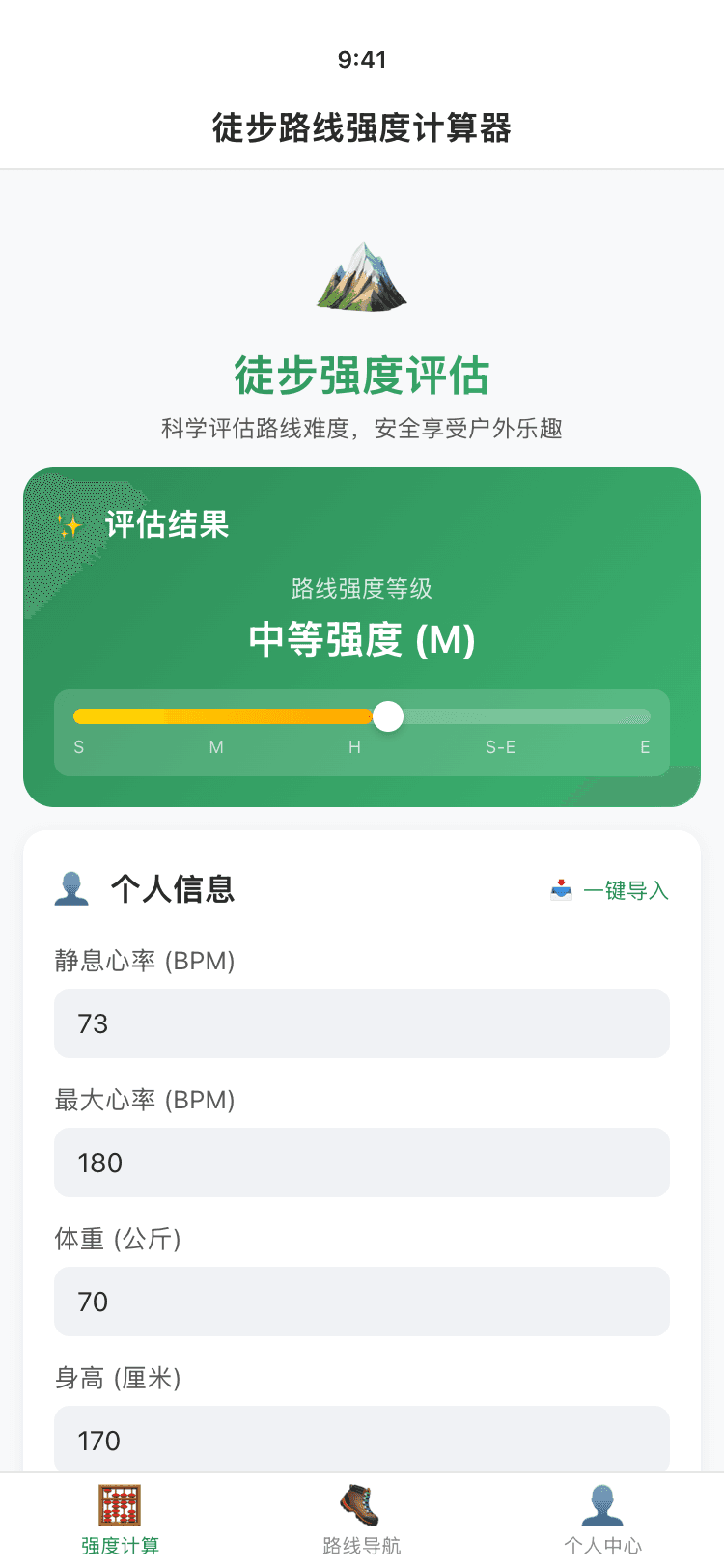
Intensity calculator
Input resting/max heart rate, distance, elevation, pack weight, body stats, duration, and weather. Outputs five levels: S · M · H · S-E · E. Logged-in users can import fitness params from the cloud.
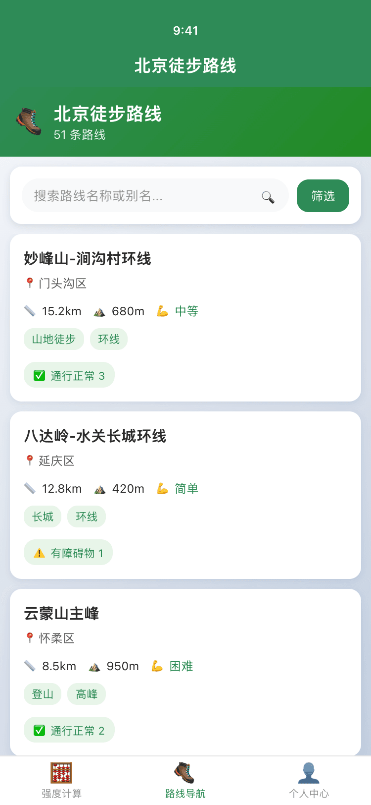
Route navigation
Search by name and aliases, filter by district and difficulty, see 30-day condition tags. Route detail splits public summary vs leader-only reports.
Crowdsourced conditions
Users report status, surface, traffic, photos, and GPS. Leaders verify reports and compute confidence. Rate limiting prevents abuse.
Archived: club activities
28 clubs aggregated (archived 2024-12-25), wx-charts popularity Top 10, Canvas 3:4 share image export.
Tech stack
| Frontend | WeChat Mini Program (WXML / WXSS / JS) |
| Backend | LeanCloud BaaS |
| Static data | GitHub Pages JSON |
| Charts | wx-charts |
| Export | Canvas 2D offscreen rendering |
| Design | CSS Design Tokens (forest green #2E8B57) |
My role
- Product — route-first migration, condition permission tiers
- Full-stack — mini program + LeanCloud + data pipeline
- Data — route index schema, condition aggregation
- UI — global design tokens, outdoor card style
Search "徒步路线强度计算器" in WeChat to try it (must be live and approved).